D.C. Puts FOI Online Following New Open Gov Order
 Mayor Vincent Gray of Washington, D.C. issued a sweeping “Transparency, Open Government, and Open Data” executive order earlier this week. Under the order, agencies will be required to use a new centralized FOIL system, proactively publish whole categories (data sets, presumably of frequently-requested records) online, and make their data available in open formats.
Civ Source Online describes the portal:
At its launch, more than 50 District agencies will be included. Additional agencies will be added to the system in the next fiscal year.
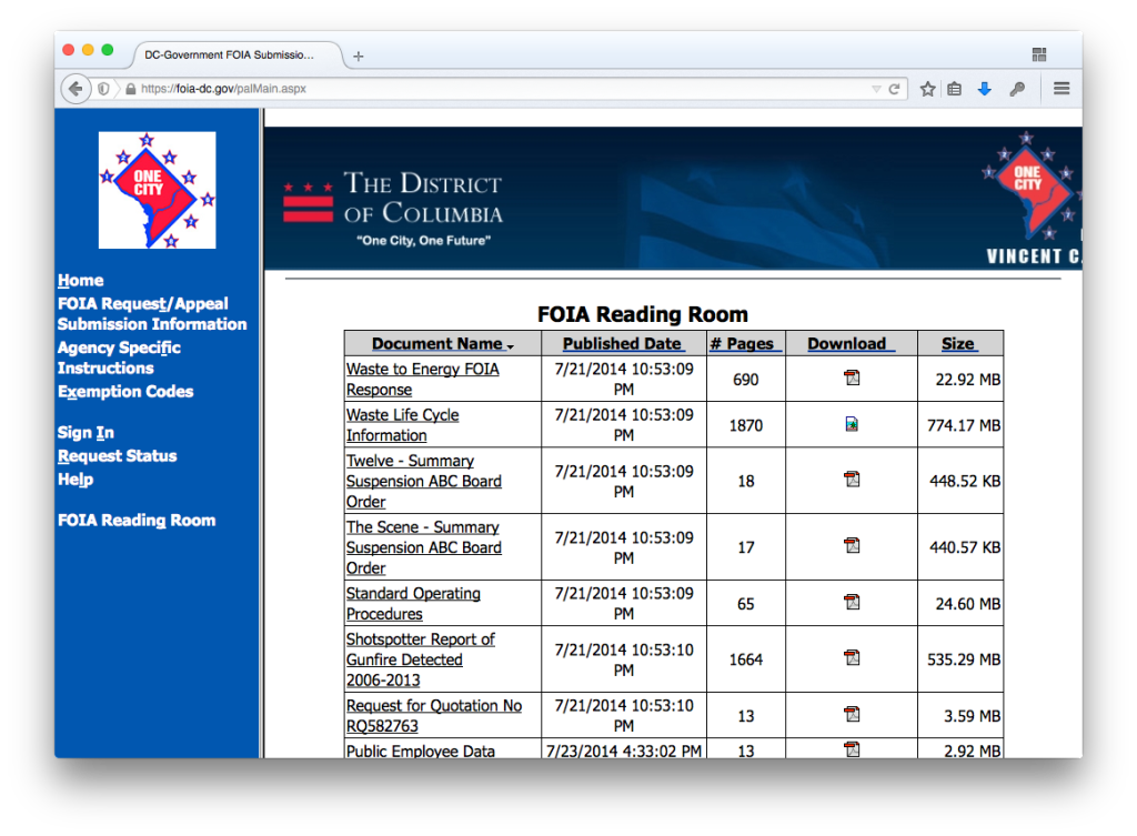
The new DC Government Public FOIA Portal will allow requesters to submit public records requests for any of the participating agencies through a centralized website. The requests will be assigned a unique tracking number, and users will be able to track the status of the request. The system will also permit the District to generate reports to determine whether agencies are meeting their FOIA obligations in a timely manner. Other documents and data sets will be published to an online reading room.
We hope NYC follows D.C.’s lead, and surpasses it by passing the NYC Open Law and launching an even better FOIL website.
We should cut D.C. some slack, given the launch was just three days ago, but we do have to note that a quick glance at the DC FOIA portal’s “Reading Room” shows that the City is not following the Mayor’s Executive Order.
For instance, D.C.’s high-profile “Shotspotter” data is online in as non-machine readable, 1,666 page .PDF document instead of a .CSV or .XLS. This non-open format means two things: the file has to be processed, or “scraped,” before it can be analyzed or mapped, and the file is a whopping 550 megabytes which requires broadband to download. The data could be stored in a CSV file of less than a hundredth that size, and be usable in a spreadsheet.
As long as we’re talking D.C. Shotspotter, the data set bizarrely fails to provide a latitude for each gunshot incident; it only lists longitudes, which makes it impossible to determine where the incident occurred.